2023
2024
May 10, 2023
Rowland Spring
About this site
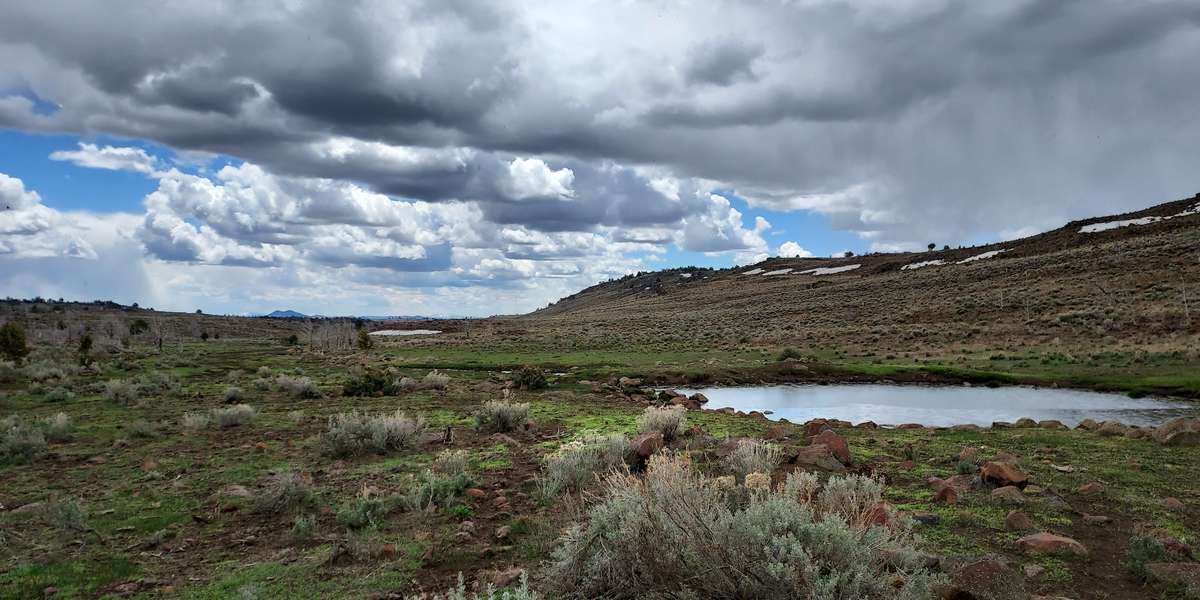
View from Rowland Spring in 2022. Springs in the high desert are important places. Located at 6300 feet above sea level and south of the Warner Mountain range, Rowland Springs is one such place. Its riparian area provides important habitat for many species including pronghorn antelope, mule deer, and greater sage-grouse. Livestock, such as sheep and cattle, and wild horses rely on the area for forage and the spring for water.
In 2022, BLM partnered with the Nevada Department of Wildlife to continue restoration efforts at the spring. The fence enclosure was expanded to protect more of the riparian habitat. Water troughs were
constructed outside the fence enclosure to provide clean water for livestock and wild horses. Greater sage grouse chicks rely on the grassy areas near springs to provide cover and food. The skeletons of juniper trees burned in the 2012 Rush Wildland Fire were removed in order to reduce the number of perches in the area for raptors who prey on the chicks. To encourage drivers to stay on the designated road, the creek crossing was improved with gravel. Erosion along the creek has disconnected it from its associated riparian area; instead of allowing the surrounding soil to absorb the water, the creek has become more like a ditch. Beaver dam analogs made from local natural materials will collect sediment and slow the pace of the water allowing the riparian area to rehydrate itself. Native vegetation- such as willows and native grasses- were also seeded and planted within the enclosure.
Some of the native plants you can see in the area include western juniper, wild rose, chokecherry, elderberry, wax currant, and gooseberry. Flowering forbs include yarrow, globe mallow, and balsamroot. Near the spring grows seep monkey flower wild mint and wild iris.
About Bureau of Land Management Applegate Field Office
The Bureau of Land Management's mission is to sustain the health, diversity, and productivity of public lands for the use and enjoyment of present and future generations.
The Applegate Field Office manages nearly 1.75 million acres in northeastern California and northwestern Nevada across the Cascade Range, Modoc Plateau, foothills of the Warner Mountains, and the Great Basin.
For nature-lovers
Explore chronologs
For organizations
Chronolog is a monitoring tool for parks, nature centers, wildlife organizations, schools, and museums worldwide. With over 100,000 contributors across 300 organizations, Chronolog is on a mission to engage communities with nature while recording important natural changes.
© Chronolog 2024 | Terms
