2024
2025
October 12, 2023 at 1:18 PM

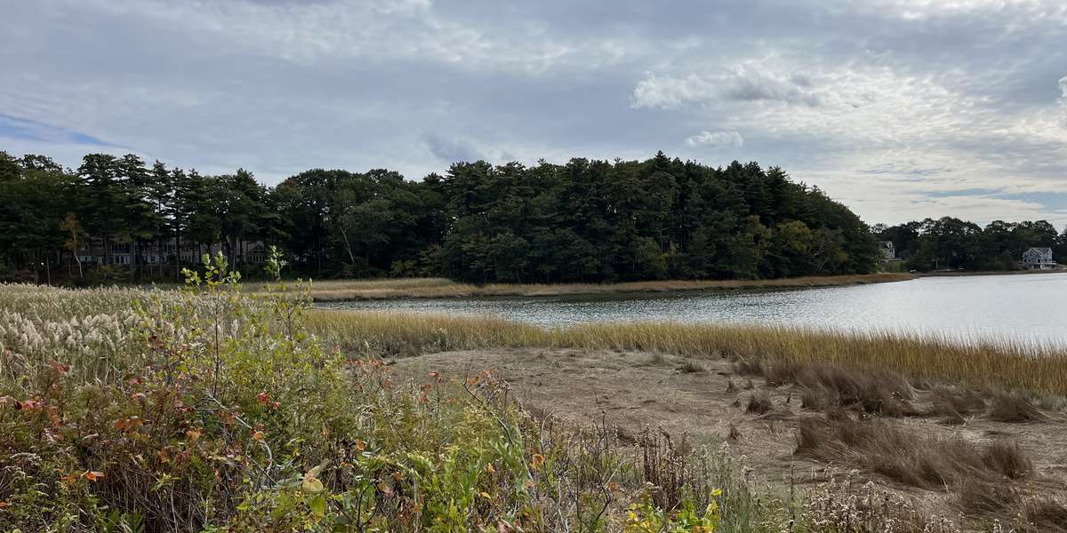
Salt Marsh at Maine Audubon's Gilsland Farm
Managed by Falmouth Land Trust
Since 2023
In Maine, US
FLT103
This chronolog combines 257 photos from 221 contributors. Learn more
About this site
This Climate Change Observatory site is positioned to monitor both invasive plant growth and water level changes. It is located at Maine Audubon's Gilsland Farm in Falmouth, Maine where Falmouth Land Trust (FLT) holds the conservation easement..
Invasive plants such as phragmites, buckthorn, and bittersweet have been identified in this area and will likely spread without intervention. The water line is also visible from this post, allowing observers to note the tidal and water level changes in the salt marsh over time. Ongoing monitoring and documentation at this site help us make more informed decisions that enhance adaptation stragegies.
We appreciate you contributing photos everytime you visit and encouraging others to participate.
There are so many ways you can can support and contribute to building our community resilience to climate change. Learn all the ways you can get involved with Maine Audubon at Gilsland Farm, and learn about FLT volunteer opportunities or join us at an FLT event or Maine Audubon event .
This project site is a collaboration between Maine Audubon Gilsland Farm, Falmouth Land Trust, and the Southern Maine Conservation Collaborative.

Maine Audubon works to conserve Maine’s wildlife and wildlife habitat by engaging people in education, conservation, and action.
About Falmouth Land Trust
The mission of the Falmouth Land Trust is to preserve and care for natural and agricultural lands in perpetuity, to enhance habitat for plants and wildlife, to advance the quality of life for all in our community, and to educate the public on the history and stewardship of protected lands.
The Falmouth Land Trust pledges itself to become a resource for all people and all groups wishing to access, enjoy, and protect natural lands. To find out more about this commitment, please click here .

Falmouth Land Trust is part of the Momentum Conservation's Climate Change Observatory Network , a photo monitoring program designed to work with environ mental organizations and communities to assist with the observation, measurement and documentation of long-term climate change trends and climate adaptation projects.
For nature-lovers
Explore chronologs
For organizations
Chronolog is a monitoring tool for parks, nature centers, wildlife organizations, schools, and museums worldwide. With over 100,000 contributors across 300 organizations, Chronolog is on a mission to engage communities with nature while recording important natural changes.
© Chronolog 2025 | Terms