2022
2023
2024
2025
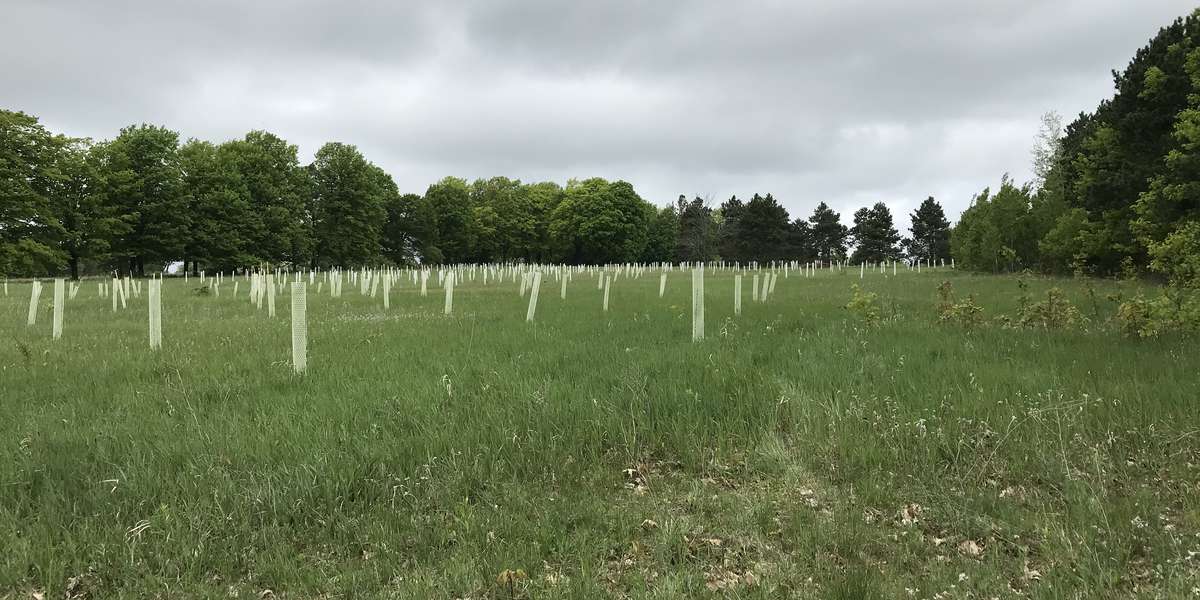
May 26, 2022 at 12:39 PM

Maplehurst Natural Area
Managed by Grand Traverse Regional Land Conservancy
Since 2022
In Michigan, US
GTR101
This chronolog combines 95 photos from 74 contributors. Learn more
About this site
This spectacular 389-acre property in Antrim County’s Milton Township is one of the largest remaining intact and undeveloped parcels near Torch Lake. It was protected by GTRLC in late 2018 after a multi-year effort in which GTRLC helped Milton Township secure a Michigan Natural Resources Trust Fund grant and fundraise for the grant’s match and other stewardship needs.
From 1955 until 2011 it was home to Camp Maplehurst, a summer camp beloved by generations of campers and counselors. This beautiful parcel has 150 acres of steep hardwood forested bluffs that drain into Torch Lake and open meadows that surround Lake Maplehurst, a 60-acre spring-fed gem. Its position on high ground means visitors have excellent views of Torch Lake, Elk Lake and Grand Traverse Bay.
About Grand Traverse Regional Land Conservancy
For nearly three decades, the Grand Traverse Regional Land Conservancy has protected and cared for the region’s natural, scenic, farm and forest lands.
With the support of individual donors, foundations and volunteers, and the partnership of local, state, and federal agencies, we have protected nearly 46,000 acres of land more than 150 miles of shoreline along the region’s exceptional rivers, lakes and streams.
Fully accredited by the Land Trust Alliance, the Conservancy is a 501(c)3 non-profit organization with our own by-laws, policies, board, budget and staff. Our service area includes Antrim, Benzie, Grand Traverse, Kalkaska and Manistee Counties.
We focus our land conservation efforts on protecting crucial wildlife habitat and corridors, critical watersheds, unique high-quality farm lands, valuable forestland and ecologically significant dunes along Lake Michigan’s beautiful and endangered shore. We protect land in several ways:
- By working with landowners to permanently protect private land through voluntary conservation easements
- By acquiring high quality natural lands by purchase or donation to create Conservancy owned nature preserves, which are open to the public
- By assisting local units of government in creating or expanding public parks and natural areas that result in enhanced public access to nature and improved recreational opportunities
- By providing technical assistance to local units of government with the administration of farmland protection programs
We think about the area we serve in terms of watersheds, coasts, scenic transportation corridors and vital clusters of our region’s working farms and forests. By considering our community in this way, we are able to evaluate how certain land uses and protection efforts will impact the things our community values – access to our majestic shorelines; opportunities for hiking, birding, canoeing, biking, fishing and other outdoor activities; safe, clean water; respect for private property rights; and a healthy economy.
Our land protection experts use a variety of conservation tools to protect significant natural and working lands. Our stewardship team documents natural and man-made features on protected land, monitors over 200 conservation easements and maintains nearly 40 nature preserves. Our fund development and outreach teams creatively build relationships with individuals and foundations to secure the resources necessary to protect water quality, natural lands, working lands, scenic views, and places where people can enjoy nature. On every level, our work is supported by hundreds of volunteer colleagues.
For nature-lovers
Explore chronologs
For organizations
Chronolog is a monitoring tool for parks, nature centers, wildlife organizations, schools, and museums worldwide. With over 100,000 contributors across 300 organizations, Chronolog is on a mission to engage communities with nature while recording important natural changes.
© Chronolog 2025 | Terms