2022
2023
2024
2025
July 22, 2021

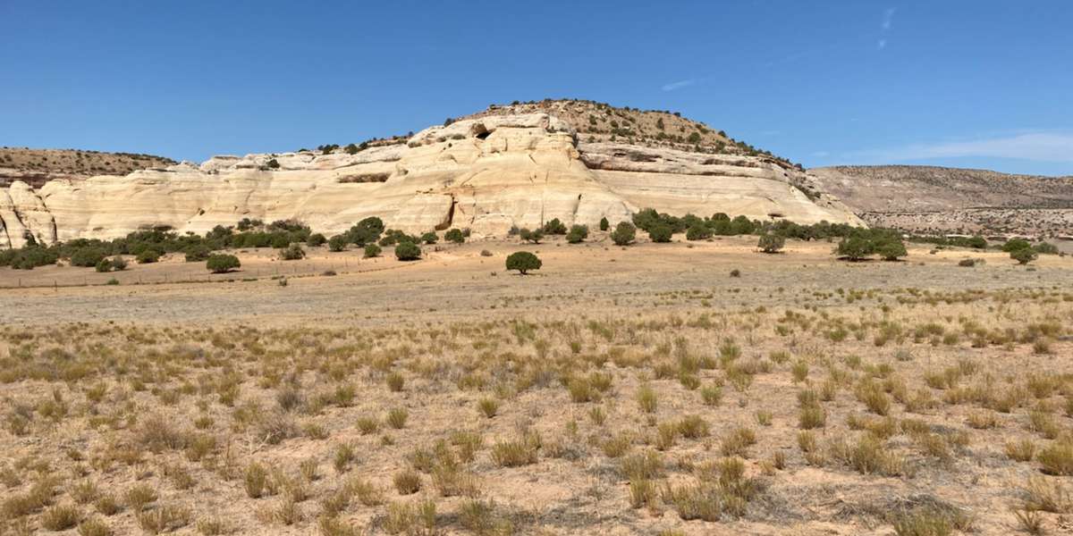
Knowles Campground, Rabbit Valley
Managed by McInnis Canyons National Conservation Area
Since 2021
In Colorado, US
MCA101
This chronolog combines 59 photos from 50 contributors. Learn more
About this site
Knowles Campground is an ideal place for visitors to camp, with access to motorized and non-motorized recreation opportunities and the incredible views of the Colorado River that characterize the Rabbit Valley area of McInnis Canyons National Conservation Area. The area surrounding the campground also happens to be popular with a non-human public land user: a rare, little-known species of desert wildflower called the Dolores River skeletonplant (Lygodesmia dolorensis). The Dolores River skeletonplant is tracked by the Colorado Natural Heritage Program because it is endemic to the Western Slope of Colorado, which means the Western Slope is the only place it the world this species can be found. Its lovely, 5-petaled pink flowers can be seen from May to August. However, this plant is an annual and germinates only in the right conditions, so it can be incredibly scarce or very common at this site depending on the amount and timing of precipitation Rabbit Valley receives that year. This Chronolog timelapse provides information on the conditions at Rabbit Valley over time and supplements data provided by the citizen science Dolores River skeletonplant monitoring project run jointly by the Bureau of Land Management and Colorado Canyons Association. Thank you for participating!
About McInnis Canyons National Conservation Area
Located in the high desert canyon country of western Colorado and eastern Utah, McInnis Canyons National Conservation Area consists of approximately 123,739 acres of BLM-administered land near Grand Junction, Colorado. Originally known as Colorado Canyons National Conservation Area, this National Conservation Area (NCA) was established on October 24, 2000, and was renamed in honor of Representative Scott McInnis on January 1, 2005. Among its unique natural resources are the more than 75,000 acres of the Black Ridge Canyons Wilderness, which includes the second-largest concentration of natural arches in North America. Internationally important fossils have been uncovered during more than a century of excavation. Pictograph and petroglyph sites abound, and the Old Spanish Trail, once referred to as the “longest, crookedest, most arduous mule route in the history of America,” runs through the NCA. Today, the NCA is a recreation destination. Visitors are drawn from all over to the opportunities experience the world-class mountain biking and straightforward, scenic river rafting offered by the McInnis Canyons NCA. The NCA benefits from the attention of a vibrant network of people, from historic and current ranching families to the active Friends groups working to protect and support this special place. Traditional land uses such as grazing continue, guided by management to protect the values for which the NCA was established.
For nature-lovers
Explore chronologs
For organizations
Chronolog is a monitoring tool for parks, nature centers, wildlife organizations, schools, and museums worldwide. With over 100,000 contributors across 300 organizations, Chronolog is on a mission to engage communities with nature while recording important natural changes.
© Chronolog 2025 | Terms