2022
2023
2024
September 20, 2021

Sieber Fire restoration site
Managed by McInnis Canyons National Conservation Area
Since 2021
In Colorado, US
MCA103
This chronolog combines 14 photos from 12 contributors. Learn more
About this site
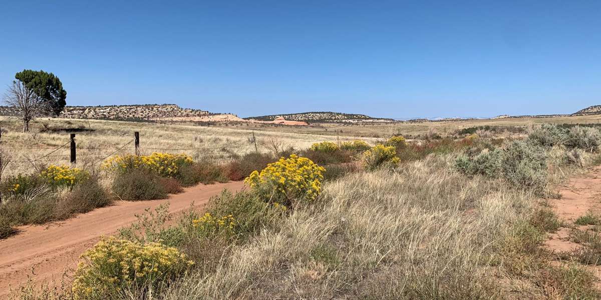
The Sieber Fire began as a lightning strike in the Blackridge Canyons Wilderness in McInnis Canyons National Conservation Area during the summer of 2020. The wildfire covered 1,094 acres of the Wilderness before it was contained. One of the most damaging potential outcomes of wildfire on the landscape is the large-scale erosion that can follow when the area has been stripped of the vegetation that stabilizes the soil. Without the forage and cover that that vegetation used to provide, wildlife can suffer as well. The autumn following the Sieber fire, volunteers and staff with the Bureau of Land Management and partner group Colorado Canyons Association collected seed from sagebrush growing in the Wilderness near the burn area. This seed was grown into seedlings by the Upper Colorado Environmental Plant Center, and then brought back to the burn area to be planted by work crews and volunteers in patches or “islands,” with locally collected pinyon and juniper deadwood scattered throughout. Research by staff at the Bureau of Land Management Grand Junction Field Office has shown that sagebrush does not regenerate in the years following wildfire (Grant-Hoffman and Dollershell 2019). When planting sagebrush, research has also shown that: A. Planting seedlings is more successful than planting seed, B. Planting sagebrush in islands is an effective and affordable way to re-establish the sagebrush flats habitat at a large scale, and C. Scattering deadwood or “microsites” throughout plantings can ensure greater seedling survival by providing young plants with a bit of extra moisture and shelter from harsh conditions (Grant-Hoffman and Plank 2020). This Chronolog timelapse provides information on the regeneration of this site over time as it recovers from the Sieber wildfire in 2020. Thank you for participating! Research cited: Grant-Hoffman, M.N. and Plank, H.L., 2020 Practical postfire sagebrush shrub restoration techniques. Elsevier, Rangeland Ecology & Management 11. Grant-Hoffman, M.N. and Dollerschell, J., 2019. Post-fire vegetation communities in western Colorado. Native Plants 20, pp. 226-237.
About McInnis Canyons National Conservation Area
Located in the high desert canyon country of western Colorado and eastern Utah, McInnis Canyons National Conservation Area consists of approximately 123,739 acres of BLM-administered land near Grand Junction, Colorado. Originally known as Colorado Canyons National Conservation Area, this National Conservation Area (NCA) was established on October 24, 2000, and was renamed in honor of Representative Scott McInnis on January 1, 2005. Among its unique natural resources are the more than 75,000 acres of the Black Ridge Canyons Wilderness, which includes the second-largest concentration of natural arches in North America. Internationally important fossils have been uncovered during more than a century of excavation. Pictograph and petroglyph sites abound, and the Old Spanish Trail, once referred to as the “longest, crookedest, most arduous mule route in the history of America,” runs through the NCA. Today, the NCA is a recreation destination. Visitors are drawn from all over to the opportunities experience the world-class mountain biking and straightforward, scenic river rafting offered by the McInnis Canyons NCA. The NCA benefits from the attention of a vibrant network of people, from historic and current ranching families to the active Friends groups working to protect and support this special place. Traditional land uses such as grazing continue, guided by management to protect the values for which the NCA was established.
For nature-lovers
Explore chronologs
For organizations
Chronolog is a monitoring tool for parks, nature centers, wildlife organizations, schools, and museums worldwide. With over 100,000 contributors across 300 organizations, Chronolog is on a mission to engage communities with nature while recording important natural changes.
© Chronolog 2025 | Terms