2022
2023
2024
2025
June 21, 2021 at 8:48 AM

Seven Bends State Park
Managed by Seven Bends State Park
Since 2021
In Virginia, US
SBS101
This chronolog combines 149 photos from 111 contributors. Learn more
About this site
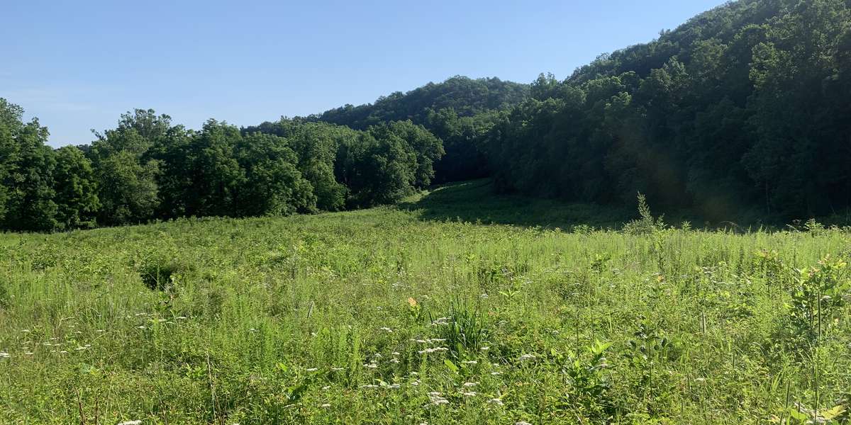
This site is on the Hollingsworth side of the park and located .6 miles down the Bass Bight Trail. This site looks over a quiet meadow nestled in-between the banks of the Shenandoah River and the Massanutten Mountain range looming in the background. The area is home to a variety of animals, including Black Bears, Bluebirds, White Tail Deer, and Wood Ducks. The photos from this site will provide a first-hand look at the changing of the season as well as the interconnected environmental changes between the river, floodplain and riparian buffer to the upland forests.
About Seven Bends State Park
Seven Bends State Park is a day-use park located in the geographically unique Seven Bends area of the North Fork of the Shenandoah River. Seven Bends State Park provides public access to the North Fork of the Shenandoah River and features two hand-carry boat launches, picnic areas, one single family-sized picnic shelter, vault restrooms, and 8 miles of hiking trails. The park provides water and land based outdoor recreational and educational opportunities while protecting and interpreting the spectacular scenic viewshed and geological, natural and historical resources of the storied seven bends area.
For nature-lovers
Explore chronologs
For organizations
Chronolog is a monitoring tool for parks, nature centers, wildlife organizations, schools, and museums worldwide. With over 100,000 contributors across 300 organizations, Chronolog is on a mission to engage communities with nature while recording important natural changes.
© Chronolog 2025 | Terms