2022
2023
2024
2025
April 17, 2021 at 11:37 AM

Fuller Farm Preserve
Managed by Scarborough Land Trust
Since 2021
In Maine, US
SLT102
This chronolog combines 177 photos from 125 contributors. Learn more
About this site
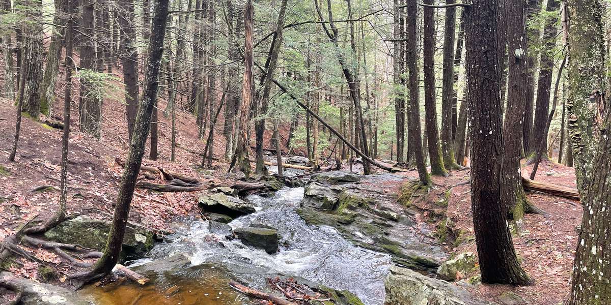
Fuller Farm is a retired mixed-agricultural site with multiple stages of mixed forest regeneration, a hayfield that is currently managed for Bobolink and wetland habitat, and a spring water fall that feeds the Nonesuch River. The Observatory is positioned on the bridge above this waterfall, facing downstream. The intention is to capture changes in flow as seasonal shifts, droughts, and storm events change through time. In 2001, SLT purchased the 150-acre Fuller Farm property from the Fuller family. For almost 100 years, Fuller Farm had been farmed for crops, livestock and hay. We purchased an additional 30-acre abutting property from Blue Rock Industries. Previously, we had received an abutting 40-acre parcel donated by Priscilla Dunn in 1997 as part of the Dunn Estates development. The Fuller Farm, Blue Rock and Dunn Estates properties are managed together as Fuller Farm Preserve and total 220 acres.
About Scarborough Land Trust
The Scarborough Land Trust is participating in the Momentum Conservation Collaborative Climate Change Observatory (CCO) Network, a photo monitoring program designed to work with environmental conservation organizations and communities to assist with the observation, measurement and documentation of long-term climate change trends.
For nature-lovers
Explore chronologs
For organizations
Chronolog is a monitoring tool for parks, nature centers, wildlife organizations, schools, and museums worldwide. With over 100,000 contributors across 300 organizations, Chronolog is on a mission to engage communities with nature while recording important natural changes.
© Chronolog 2025 | Terms