2024
2025
April 17, 2024 at 5:01 PM

Paonia River Park
Managed by Western Slope Conservation Center
Since 2024
In Colorado, US
WSC101
This chronolog combines 86 photos from 44 contributors. Learn more
About this site
History of the Paonia River Park
The Paonia River Park is a popular spot for locals and visitors who come to walk the trails, swim in the river, and enjoy nature. Once an in-stream gravel mine, the North Fork River Improvement Association, now the Western Slope Conservation Center, (WSCC) worked closely with the community to reclaim the river, restore riparian habitat, and make the park a family-friendly recreation area. WSCC completed the Paonia River Park Restoration Project in 2013, and in 2016 the park expanded to include an interpretive trail system. The River Park now hosts a shaded picnic area, outdoor classroom, boat launch, river viewing platform, an ADA compliant access ramp, walking trails and interpretive signage. The park is one of only two public access points along the North Fork of the Gunnison river where over 95 percent of riverfront property is privately owned. WSCC is committed to connecting the community to the river, maintaining a balance between natural and built structures, and ensuring project sustainability through public participation.
Why monitor this area?
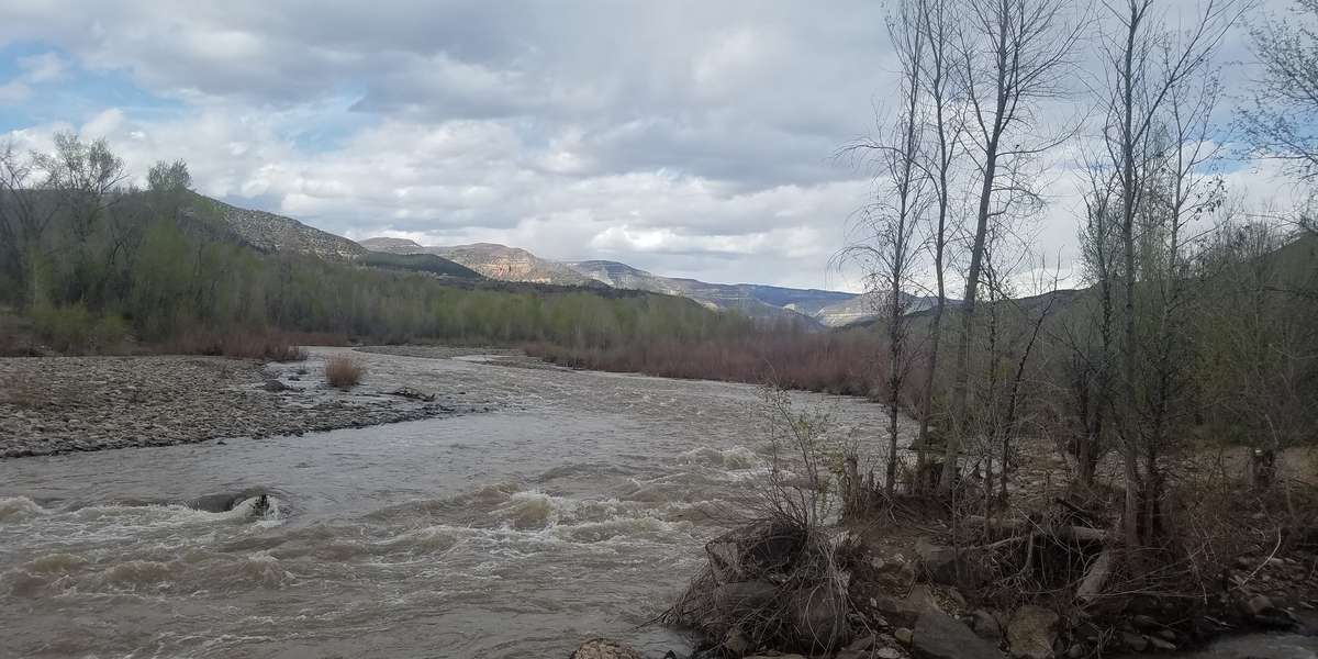
The North Fork of the Gunnison River is a dynamic river that provides recreation and natural value, as well as irrigation water for the agriculture that sustains this valley. Situated in the headwaters of the Colorado River, water flows vary year to year depending on the winter snowpack conditions, with runoff typically beginning in mid spring. By late summer, flows are vastly lower. Visually capturing these changes from season to season, and from year to year, can provide a new source of data to illustrate changes in riparian areas and the river channel. For instance, a recent high spring run-off season brought much needed relief from drought, but also intense destruction as the North Fork reached near fifty-year flood stage levels. The high water toppled large trees, cut new meanders, rearranged islands, scoured banks, and deposited thousands of tons of river cobble to create new point bars along its thirty three miles. Impacts to the Paonia River Park, included washed out trails, displacement of rocks, debris left scattered throughout the area, and severe undercutting of a riverbank that led to the collapse of a trail.
This area also supports significant wildlife habitat. For instance, we recently noticed the presence of new neighbors in the park, a pair of beavers. With our Chronolog station, we hope to also document their impacts to the area.
Thank you for helping WSCC document the power and beauty of our river!
About Western Slope Conservation Center
We formed in 1977 to disseminate information about regional energy development and its impacts on the region’s natural resources. Today, our mission is to build an informed and engaged community to protect and enhance the lands, air, water and wildlife of the Western Slope. We envision landscapes defined by resilient ecological systems, where water management, agricultural practices, and recreation opportunities allow people and the environment to flourish.
For nature-lovers
Explore chronologs
For organizations
Chronolog is a monitoring tool for parks, nature centers, wildlife organizations, schools, and museums worldwide. With over 100,000 contributors across 300 organizations, Chronolog is on a mission to engage communities with nature while recording important natural changes.
© Chronolog 2025 | Terms